


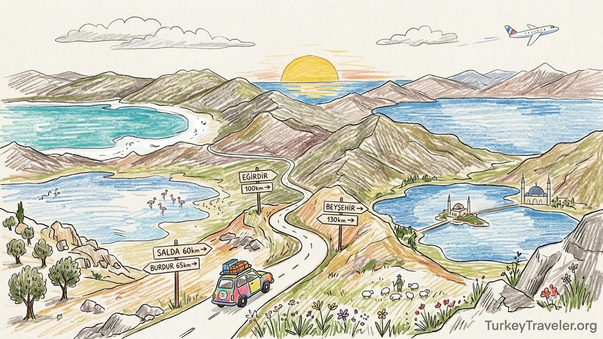
On the map, Turkey’s Lakes District appears as a tight constellation of blue dots scattered across southwestern Anatolia. Zoom in on a phone screen and the names Salda, Burdur, Eğirdir and Beyşehir sit close enough that combining them in a single day seems almost efficient. It is only when you start following the actual roads, climbing over the Taurus foothills and slowing for tractors and hairpin bends, that the illusion of a compact “Lake District” falls apart.
When “Lake District” Sounds Closer Than It Really Is
The phrase “Turkish Lake District” suggests something like England’s compact Lakeland, where you can stroll from one valley to the next. In reality, Turkey’s version stretches across a broad plateau and the folds of the Taurus Mountains. Major lakes like Salda, Burdur, Eğirdir and Beyşehir can sit 60 to 120 kilometres apart, connected by single-carriage roads that wind through villages and over passes rather than fast motorways.
Official tourism campaigns unintentionally reinforce the illusion of proximity. The national tourism portal’s two-day photography route for Isparta’s Lakes District, for example, highlights just eight scenic points yet already totals around 350 kilometres of driving and roughly six hours behind the wheel. This is within a single province and its immediate surrounds, not even the whole region. On a map, the loop looks gentle and compact. In practice, the odometer tells a different story.
For independent travellers, it is easy to glance at a navigation app, see 70 or 80 kilometres between lakes, and translate that into a casual “about an hour.” Once you are on the road, speeds drop, scenery invites stops and small delays accumulate. A detour for a village bakery, a photo stop over a valley, or construction works outside Burdur can each eat ten or fifteen minutes. By late afternoon, the optimistic plan of “four lakes in a day” has quietly become a race against sunset.
The core problem is not a lack of transport options or poor road conditions. You can reach these lakes by rental car, intercity bus or local dolmuş. The issue is scale, expectations and the way we read maps on screens. Distances that look trivial from above turn into full driving days once you factor in mountain roads, lunch, swimming stops and the simple desire to enjoy the lakes instead of just ticking them off.
The Route That Looked Perfect on Paper
Look at a map of southwestern Turkey and it is easy to sketch a loop that takes in Salda, Burdur, Eğirdir and Beyşehir in a single ambitious day. Salda sits northwest of Yeşilova in Burdur province. Burdur Lake lies near the provincial capital to the northeast. Eğirdir spreads out about 46 kilometres north of Isparta’s city centre, and Beyşehir straddles the border between Konya and Isparta provinces. The cluster looks dense, almost walkable with your fingertip.
Start, for instance, from a guesthouse near Salda’s public beach. Local authorities note that Yeşilova, the district town for Salda, is about 56 to 60 kilometres from Burdur city by road, typically an hour’s drive when you account for slower traffic through villages. From Burdur, the main road to Eğirdir runs roughly 60 to 65 kilometres, taking another hour or so depending on stops and slow-moving trucks. From Eğirdir to the southern shore of Beyşehir, distances range around 90 to 100 kilometres, adding at least one and a half hours. All told, you are looking at around 210 to 230 kilometres of driving just between lakes, not counting the approach from a bigger hub like Antalya or Denizli.
On a navigation app, those hops appear as neat, coloured lines with reassuring ETAs: 1:05, 1:10, 1:30. Many travellers, myself included, underestimate how those numbers feel when strung together with real-world stops. It is one thing to drive an hour from a city hotel to a single beach and linger. It is another to repeat that same hour-long segment three or four times in sequence, on two-lane roads where overtaking slow trucks is limited by curves and oncoming traffic.
The official Isparta photography route’s 350-kilometre two-day loop is a sobering benchmark. If curated experts, working with just a handful of carefully chosen stops, already clock six hours of driving over two days, then any plan that tries to bolt Salda, Burdur, Eğirdir and Beyşehir together in a single daylight window is likely to be top-heavy with asphalt. The math does not leave much room for shoreline time.
How the Day Actually Unfolded Behind the Wheel
Consider a real-world attempt to “do it all.” The plan began with sunrise at Salda, coffee from a small kiosk by the white shore, then a late-morning stop at Burdur, lunch overlooking the lake’s flamingo shallows, an afternoon swim and stroll in Eğirdir, and finally golden-hour photos at Beyşehir before returning to a hotel somewhere along the route. On the map, each transfer looked manageable, and the entire loop promised a satisfying sense of completion.
The day started well but already slipped behind schedule by mid-morning. Leaving Salda’s main beach car park just after 9:30, we allowed for an hour to reach Burdur along the D330 road. Traffic through Yeşilova and roadworks near a junction added almost 20 minutes. A petrol station stop for fuel, bottles of water and a quick restroom break turned into another 15. By the time we actually reached Burdur’s lakefront promenade, it was nearly 11:30.
Lunch crept longer than planned. Local restaurants serve hearty plate meals, and service is friendly but unhurried outside the peak of summer. Choosing a spot with lake views, ordering grilled chicken, salad and ayran, and juggling questions from the owner about where we were from easily filled an hour and fifteen minutes. We walked a short section of the promenade, watched a line of flamingos in the distance and finally got back to the car around 13:15.
The next leg to Eğirdir looked like a simple 60-kilometre hop. Yet the two-lane road threaded through agricultural villages, with tractors and heavily loaded trucks pulling the pace down. A tempting viewpoint above a patchwork of fields invited a ten-minute photo pause. By the time we rolled across the causeway to Eğirdir’s Green Island and parked under pine trees, it was after 14:45. Swimming, strolling through the back lanes and stopping for tea on a lakeside terrace filled the rest of the afternoon. The optimistic idea of reaching Beyşehir for sunset started to feel increasingly theoretical.
The Moment the Schedule Broke: Missing Beyşehir at Sunset
The turning point came at 17:00 in Eğirdir. Navigation showed roughly 95 kilometres to a viewpoint on Beyşehir’s southern shore, with an estimated drive time of one hour and forty minutes on the secondary road that follows the provincial border. Sunset at that time of year was just after 19:30. On paper, the numbers still lined up: leave by 17:00, arrive before 19:00, capture the warm evening light shimmering on Turkey’s largest freshwater lake, then find dinner.
Reality again intruded. Leaving the island meant creeping through Eğirdir’s narrow main street behind a delivery van. Once out of town, the Beyşehir road climbed into forested hills, with bends tight enough that most local drivers kept below 70 kilometres an hour. Occasional flocks of sheep, a stretch of resurfacing and one particularly scenic valley overlook chipped away at the margin. Each micro-delay felt minor in the moment. Collectively, they moved our arrival time from 18:40 toward 19:15.
By the time we reached a lakeside picnic area on the Beyşehir shore, the sun was already flirting with the horizon, and long shadows stretched over the reed beds. Technically we had “made it” for sunset, but not in the sense that the original plan imagined. There was no time for a walk along the shoreline path or a boat ride from the small pier. Instead, we watched the last colour fade from the sky from the car park, huddled in light jackets against a surprisingly cool breeze, then drove into town in the dark to search for dinner.
The cost of trying to link four lakes was precisely this: Beyşehir became little more than a box ticked. We glimpsed the expanse of water from the roadside and a gravel parking lot but never settled into the place. There was no unhurried stroll past the old stone mosque, no exploration of side streets, no quiet half-hour on a bench listening to waves. The schedule had left just enough time to arrive, but almost no time to exist beside the water.
Where the Map Misleads: Scale, Roads and Human Needs
The root of the problem lay less in the absolute distances and more in how screens compress them. On a digital map, a 50-kilometre line and a 150-kilometre line can look deceptively similar depending on zoom level. The Turkish Lake District is built around a chain of large tectonic lakes within the folds of the Taurus range, not along a straight coastal highway. Roads curve, climb and descend. They pass through market towns that act as natural speed bumps, both literally and culturally.
Another factor is the difference between official driving times and real traveller behaviour. Navigation apps calculate ETAs based on legal speed limits and typical traffic. They do not account for ten minutes to buy cherries from a roadside stall, five minutes to photograph a field of poppies, or a surprise temple ruin signposted just off the road. In a region known for its ruins, national parks and viewpoints, those small pauses are part of the appeal. Yet they quietly stretch a day that already tries to cover too much ground.
The terrain also affects energy levels. Switching from fast motorways near Antalya or Denizli onto narrower provincial roads requires more attention. Frequent curves, oncoming headlights at dusk and occasional livestock on the tarmac all demand alert driving. After four or five hours of this style of driving broken into multiple segments, your enthusiasm for a late, chilly swim or a long lakeside walk naturally dips, even if the light is still good.
Human needs amplify the stretch. Lunch in a family-run lokanta is unlikely to be a 20-minute dash. Coffee after a meal, especially in Burdur or Isparta where café culture is strong, adds another half-hour. Refuelling and bathroom breaks tend to cluster around these same moments. A realistic day that includes three or four lakes must therefore count on at least two substantial stops, which together can equal three hours away from the wheel. Once you subtract that from daylight, the margin for long inter-lake transfers shrinks dramatically.
Lake Combinations That Work and Those That Do Not
Experience and the distances involved suggest that some pairings in the Lake District feel naturally coherent, while others strain a single day to breaking point. Salda and Burdur, for instance, sit within about an hour and fifteen minutes’ drive of each other via Yeşilova and the D330 highway. Starting with a morning swim and photo session at Salda’s white shores, then driving to Burdur for a leisurely lakeside lunch and short promenade walk, leaves enough time to return to Salda for a different light or to continue to a nearby town for dinner.
Eğirdir and nearby Kovada or Gölcük form another logical cluster. Eğirdir lies roughly an hour from Isparta city, and provincial tourism information highlights it alongside closer mountain lakes and national parks. Travelling from Isparta to Eğirdir for a day of swimming, walking the causeway to Green Island and taking a short boat trip fits easily into daylight hours, even with a mountain detour. The road to Kovada Lake National Park continues south from Eğirdir, offering a forest-framed freshwater contrast that does not demand another multi-hour transfer.
By contrast, trying to stitch Salda, Burdur, Eğirdir and Beyşehir into one loop piles up kilometres in a way that dilutes every stop. From Salda to Burdur you spend about an hour. Burdur to Eğirdir takes another hour or a bit more. Eğirdir to Beyşehir adds 90 minutes or longer on sinuous roads. If you include at least an hour in each place, plus two meal breaks and fuel, you quickly exceed available daylight outside high summer. What looked “efficient” in the planning phase becomes a day of constant departure.
Short-cut temptations often make things worse. Looking at a map, you might be tempted to cut from Beyşehir directly back to a base near Isparta at night, saving distance by avoiding main highways. Locals and guidebooks, however, advise caution on narrow mountain roads after dark. Any time you feel compelled to rush through a lake visit in order to avoid night driving in unfamiliar terrain, the itinerary has tipped from enjoyable into overextended.
A Revised Route: Fewer Lakes, Deeper Days
The lesson from that overloaded loop was simple: treat the Turkish Lake District not as a checklist, but as a set of overlapping micro-regions. Instead of racing between four major lakes in one day, build an itinerary around one base and a realistic daily radius. That way, the lakes become destinations to inhabit, not distant blue shapes to glance at from car windows.
One workable revision begins with choosing Eğirdir as a two-night base. The town offers a mix of small guesthouses on Green Island, lakeside pensions on the mainland and basic hotels in the centre. Prices fluctuate with the season, but travellers in recent years have commonly found mid-range double rooms for a fraction of big-coast resort rates, especially outside peak school holidays. From this base, you can devote a full day to exploring the town, swimming from small public platforms, renting a bicycle to follow the shore in one direction and sampling fresh fish in simple restaurants that look directly across the lake.
The second day can then reach outward, but only as far as still feels humane. A morning drive to Kovada Lake National Park, a forested basin tucked south of Eğirdir, allows for gentle lakeside paths and picnic spots. Returning via mountain viewpoints, you can still be back in Eğirdir in the late afternoon, with plenty of time for a final swim and sunset watch. If you crave variety, Gölcük near Isparta or a short detour to a village known for apples or cherries fit comfortably within this radius without repeating the stress of a multi-lake sprint.
Travellers particularly drawn to Salda’s turquoise water and striking white shoreline might instead choose Yeşilova or Burdur as their base. A revised plan could allocate one full day purely to Salda, exploring different bays, renting a pedal boat if available in season and simply sitting on the shore. A second day can be spent around Burdur Lake and the city’s museum or café scene. Eğirdir and Beyşehir still exist on the map, but they can be saved for a future trip centred further north and east, perhaps linked with Konya or Isparta rather than squeezed into an already full western loop.
Planning for Real Travel Time, Not Map Distance
Reframing Lake District planning means thinking in hours rather than centimetres on a map. Start by estimating honest door-to-door driving times between two points, then adding a buffer of at least 25 percent for unscheduled stops, slow vehicles and construction. If a navigation app says Salda to Burdur requires one hour, assume you will spend one hour and fifteen minutes. If Eğirdir to Beyşehir is projected at one hour and forty minutes, plan for two full hours. In a region with enticing roadside views, that margin will almost certainly be used.
Next, decide how much actual lake time you want in a day. If your ideal is three or four hours of swimming, walking or simply sitting near the water, plus two relaxed meals, you may already have filled eight hours without counting transfers. Any day that stacks more than three separate one-hour drives on top of that is likely to feel compressed. Instead, aim for a pattern of one substantial transfer in the morning, followed by a settled afternoon and evening in a single place.
It also helps to lock in at least one non-negotiable low-energy block each day: perhaps two hours by the water with phones on airplane mode, or a strict rule that you will not start any new drives after 17:30. These guardrails counteract the temptation to chase “just one more lake” or an extra viewpoint before dark. In the Turkish Lake District, where evenings on the shore can be the most beautiful part of the day, protecting that time can transform a rushed itinerary into a restorative one.
Finally, keep in mind that conditions and rules at individual lakes can change. Shoreline access points at Salda, for instance, have seen increased regulation in recent years to protect fragile environments. Seasonal closures or shifting parking arrangements can add walking time from car parks to the water and back. Building generous slack into your schedule means that such changes do not derail your entire day or force you into unsafe night driving on unfamiliar roads.
The Takeaway
The biggest surprise of Turkey’s Lake District is not its beauty but its scale. From a distance, Salda, Burdur, Eğirdir and Beyşehir cluster together as if they could be visited between breakfast and dinner. On the ground, they reveal themselves as large, distinct worlds separated by serious stretches of asphalt and mountain. Official promotion of a 350-kilometre two-day photography loop within just one subregion underscores how travel here is measured in hours, not in pinches on a screen.
Attempting to chain multiple major lakes into a single day often turns shoreline time into brief interruptions between drives. Our own effort to link Salda, Burdur, Eğirdir and Beyşehir resulted in late arrivals, extended lunch stops, traffic delays and, ultimately, a sunset at Beyşehir witnessed mainly from a car park. The lakes themselves were never the problem. The misreading of distances and the urge to collect names were.
A more satisfying approach chooses depth over breadth. Pick one base, such as Eğirdir or Yeşilova, limit each day to one or two lakes within a comfortable radius, and give yourself permission to linger. Let drives be framed by coffee, swims and slow walks rather than by the next obligation. The names on the map will still be there when you return. The memories you make by actually inhabiting a single shoreline will be far richer than any list of lakes glimpsed through a windscreen.
FAQ
Q1. Can I visit Salda, Burdur, Eğirdir and Beyşehir in one day by car?
It is physically possible in summer daylight, but you will spend most of the day driving with only brief stops at each lake, which many travellers find unsatisfying.
Q2. How long does it really take to drive between these lakes?
Roughly speaking, Salda to Burdur is about an hour, Burdur to Eğirdir about another hour, and Eğirdir to Beyşehir at least one and a half to two hours, not counting fuel or photo stops.
Q3. Which lakes combine best for a relaxed day trip?
Salda and Burdur work well together from a base in Yeşilova or Burdur, while Eğirdir with nearby Kovada or Gölcük makes a natural pairing from a base in Isparta or Eğirdir itself.
Q4. Is it safe to drive between the lakes after dark?
Major roads are generally maintained, but many routes are narrow and winding. Most travellers prefer to avoid unfamiliar mountain roads after dark and to finish drives before sunset.
Q5. Where is a good place to base myself in the Lake District?
Eğirdir is a popular base for exploring northern lakes, with guesthouses on Green Island and in town, while Yeşilova or Burdur suit travellers focusing on Salda and Burdur Lake.
Q6. Do I need my own car to explore the Turkish Lake District?
A car offers the most flexibility, but you can reach hubs like Burdur or Isparta by intercity bus and then use local buses, taxis or organised day trips to specific lakes.
Q7. How many lakes should I plan to see in two days?
For a relaxed pace, focus on one main lake each day, with perhaps a secondary nearby lake or viewpoint, rather than trying to tick off every major name on the map.
Q8. Are there seasonal factors that affect driving times?
Yes. Summer brings more traffic and roadworks, while winter can mean shorter daylight and occasional icy patches at higher elevations, which all lengthen effective travel times.
Q9. How should I adjust my schedule for photo stops and meals?
Add at least 25 percent extra time to any navigation estimate, and budget a full hour for sit-down meals so that photo pauses, fuel stops and café breaks do not cause late arrivals.
Q10. What is the main planning mistake travellers make in the Lake District?
The biggest mistake is assuming that lakes that look close together on the map can all be visited deeply in one or two days, which leads to rushed visits and too much time in the car.