

By the time I stepped out of the car above the town of Ağlasun, the Mediterranean coast already felt far away. The air was cooler and sharper, scented with pine and rock instead of sea salt and sunscreen. Ahead of me, the road kinked upward toward Sagalassos, a Roman city tucked between 1,450 and 1,700 meters above sea level, and the reason I had traded Antalya’s beaches for a day in the clouds.
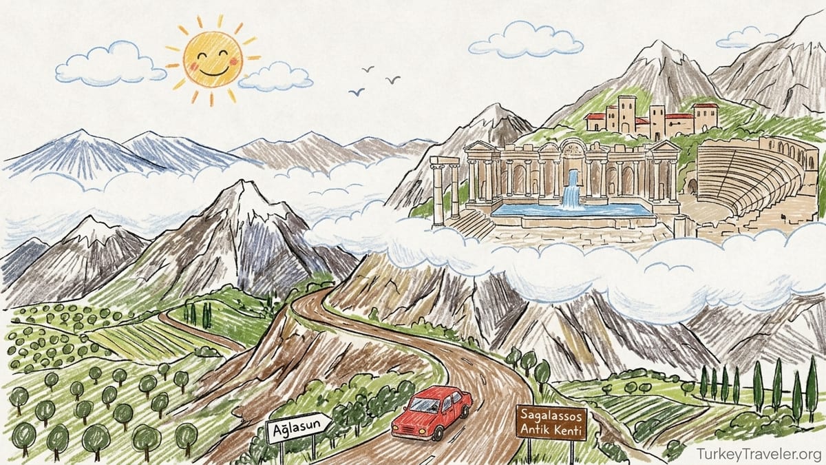
Reaching a Roman City in the Clouds from Antalya
I set out from central Antalya just after 8 in the morning, picking up the D650 highway that runs north toward Burdur. The first part of the drive feels deceptively ordinary: dual carriageway, fuel stations, and green roadside signs pointing toward Burdur and Isparta. Once you leave the sprawl of Antalya behind, though, the mountains begin to gather on the horizon and the road starts to climb. Sagalassos lies roughly 100 to 115 kilometers north of Antalya depending on your starting point in the city, and with a couple of short breaks the journey by rental car took me just under an hour and a half.
At around the 80-kilometer mark, a brown heritage sign finally appeared for Ağlasun and Sagalassos. I turned off the D650 onto the smaller D685, then quickly onto the signed road to Ağlasun, and the character of the drive changed immediately. The highway’s smooth sweep gave way to a narrower mountain road, twisting above olive groves and small farms. It is fully paved but involves enough hairpins and sudden views into deep valleys that any driver unused to mountain roads will want to take it slowly. Local drivers know every curve, so I kept an eye on my mirrors and let the faster ones pass whenever I found a safe lay-by.
Ağlasun itself sits in a bowl of hills beneath the ruins. The town is a modest cluster of low-rise houses, tea gardens, and minimarkets, with several signs pointing up to “Sagalassos Antik Kenti.” From here the site is about 7 kilometers, but those are some of the steepest and most dramatic of the day. The road narrows further and begins to zigzag up the slope, with concrete crash barriers on one side and the mountain dropping away on the other. In late September when I visited, the weather was clear and dry. In winter and early spring, snow and ice can affect this stretch, and it is worth checking local conditions before setting out.
The final ascent was the most memorable. With each bend, Ağlasun shrank further below, its red roofs compressed into a patchwork against the green valley. The air temperature dropped a couple of degrees and the wind picked up, buffeting the car in exposed spots. When I finally reached the parking area just below the ticket office of Sagalassos, my altimeter app showed roughly 1,450 meters. The sense of having climbed into a different world was immediate and profound.
First Steps Inside Sagalassos: Tickets, Facilities, and the Mountain Air
The entrance to Sagalassos is understated for such a monumental place. A compact ticket office sits beside a small visitor building with toilets and basic information panels. In 2026, the official listing from the provincial authorities gave opening hours as 09:00 to 17:30, with the ticket office closing around 17:00, but at the site and in local tourism materials I saw notices indicating that in September closing was extended to 19:00. The safest advice is to check current hours before you drive up, especially outside summer or in Ramadan when hours can shift.
Ticket prices change periodically, so I will not quote an exact figure, but in autumn 2026 the single adult admission was in the low hundreds of Turkish lira, similar to other major archaeological sites in the region. The Museum Pass Türkiye and regional cards were accepted for entry when I visited, which made sense for travelers planning a circuit that includes places like Perge, Termessos, or Hierapolis. There was no extra parking fee at the time of my visit. Toilets at the entrance were basic but clean, and there was a small kiosk selling bottled water, soft drinks, and a limited range of snacks.
Even at the ticket office, the altitude made itself felt. The sky seemed closer, a deep and almost metallic blue, and the sun felt fierce whenever the wind dropped. Sagalassos lies between roughly 1,450 and 1,700 meters, which is not enough to cause altitude sickness for most people, but it is enough to change the quality of light and air. I reapplied sunscreen, tightened the straps on my walking shoes, and refilled my water bottle before starting up the path. There are no shaded cafes or extensive services deeper in the site, so it pays to start with more water than you think you will need.
There is an accessible route along part of the lower terraces, but Sagalassos is fundamentally a mountain city, and much of the experience involves steep and uneven paths. Anyone with limited mobility, serious knee problems, or difficulty with balance should be prepared for frustration and may want to enjoy the views and lower ruins rather than attempting the full climb to the upper agora.
Climbing Through the Lower City: Agora, Baths, and Streets
The modern path into Sagalassos is cleverly aligned with the ancient topography. Rather than dropping you directly into the showpiece ruins, it guides you onto a terrace that once formed part of the lower urban zone, then leads you upward from there. The first major space I entered was the Lower Agora, a gently sloping plaza edged with the foundations of shops and administrative buildings. In its Roman prime, this would have been the commercial heart of the city, where traders sold oil, wine, and the red-slipped pottery that made Sagalassos famous.
Standing there, the mountain setting feels almost surreal. Instead of a coastal plain or river valley, the agora opens onto a backdrop of ridges and peaks, with the Taurus Mountains folding away toward the horizon. When a gust of wind swept across the terrace, it carried the clink of loose stones and the distant sound of cowbells from far below, where modern herders still graze their animals. The paving is uneven, a mosaic of original slabs, rougher patches, and reconstructed edges, so I watched my footing carefully as I crossed the square.
From the Lower Agora, I followed a stepped street that curved uphill, its ancient flagstones polished by nearly two millennia of feet and, more recently, the boots of archaeologists and tourists. On one side, low walls marked the remains of domestic buildings: houses that once looked down toward the agora and out toward the valley. Many of these areas were cordoned off, both to protect ongoing excavations and because the ground has collapsed or shifted over the centuries, leaving hidden cavities beneath fragile surfaces. Sagalassos is not a “walk everywhere” kind of site. You move along defined paths, sometimes over metal walkways that span excavated rooms and channels.
A little further up, the massive bulk of the Roman baths came into view. This was one of the largest building complexes in the city, with vaulted halls, hypocaust heating systems, and cold and hot water pools. Today, substantial walls and arches still stand, their brick and stone patterns exposed where plaster and marble once covered them. Access is limited for safety reasons, but from the designated viewpoint you can peer into the caldarium and frigidarium spaces and trace the lines of ancient underfloor heating channels. Again, the terrain is rough, and some steps lack handrails. I noticed several visitors turn back here, either winded from the climb or uneasy about the footing.
The Theatre and the Steep Reality of a Mountain Ruin
Above the baths, the path forks. One branch leads toward the theatre, carved spectacularly into the mountain slope, while the other continues its ascent toward the upper agora and the Antonine Nymphaeum. Tempted by the promise of a high viewpoint, I took the theatre path first. It is steeper and rockier than the main route, with loose gravel underfoot. At one point the trail narrows between a stone wall and a precipitous drop, and I found myself slowing to ensure each step was secure.
The theatre itself is a partial ruin yet still monumental. Many of the cavea seats survive in jagged tiers, grass and small flowers tufting between the stones. Parts of the stage building have collapsed dramatically downslope. There was no unrestricted access to the seating when I visited, both because of conservation work and concerns about rockfall. Instead, a roped path brings you to a broad platform from which you can look across the theatre bowl and out over the valley. The combination of high altitude, empty seats, and silence broken only by the wind gives this spot an eerie power.
Standing there, it struck me how different Sagalassos feels from coastal sites like Perge or Side. At those ruins, traffic hums faintly in the distance, and you are never far from a cafe or shop. Here, the only manmade sounds were the murmurs of other visitors and the distant whine of a motorbike climbing toward Ağlasun below. The theatre is a highlight, but it requires confidence on uneven terrain and is not recommended for anyone who struggles with steep paths or vertigo.
By the time I retraced my steps down from the theatre fork and rejoined the main path, my calves were beginning to feel the climb. I paused at a low wall, watching cloud shadows slide across the slopes opposite, and drank deeply from my water bottle. That pause, at roughly the midpoint between the lower and upper city, made the next stage feel less like a slog and more like a pilgrimage.
Reaching the Upper Agora and First Glimpse of the Antonine Nymphaeum
The path grew steeper as I approached the upper terraces. Here the remains of colonnaded streets and monumental staircases begin to crowd together. Broken columns lie like felled tree trunks along the route, and reconstructed sections rise again in clean, pale shafts. The sense of climbing through the skeleton of a city becomes almost overwhelming. Signboards provide brief explanations in Turkish and English, but much of the impact is simply visual and physical: you climb, your breathing quickens, and the buildings grow larger and more elaborate with each turn.
Finally, the path delivered me onto the edge of the Upper Agora, and for a second I forgot about the altitude, the wind, and even the climb. On one side, the open plaza stretches out, ringed by the foundations and partial walls of administrative and religious buildings. On the other, pressed against the rising slope of the mountain, the Antonine Nymphaeum stands in layered tiers of marble, its reconstructed façade gleaming against the darker rock behind it. It is impossible to miss and impossible to mistake for anything but the centerpiece of the upper city.
The Upper Agora itself is less intact than the fountain that dominates it, but the scale is easy to read. You can trace the edges of porticoes, imagine stalls or offices in the rooms behind, and sense where crowds once gathered around statues and inscriptions. The paving has been partly relaid, partly left as excavation exposed it, so again careful stepping is essential. I walked slowly across the square, drawing closer to the nymphaeum with each step, the sound of modern voices dropping away as the trickle of water reached my ears.
This gradual reveal, from car park to lower agora to baths, theatre, and finally upper agora, is what makes Sagalassos such a compelling place to visit. You feel the vertical structure of the city in your legs. Status rose with altitude in many ancient communities, and here that metaphor becomes literal. By the time you stand before the Antonine Nymphaeum, you have earned the view.
The Antonine Nymphaeum: A Working Monument Reborn
Up close, the Antonine Nymphaeum is both immense and surprisingly delicate. Built in the later second century AD, roughly between 160 and 180, it once stretched about 28 meters across and rose around 9 meters high. Its basin could hold roughly 81 cubic meters of water, fed by channels that brought mountain spring water into the heart of the city. Even now, when you stand near the center of the façade, the monument feels like a manmade cliff of sculpted stone and shadow.
When I visited, water was indeed flowing. It emerged in a steady sheet from the central niches, spilling into the long rectangular basin below with a continuous, low roar. The sound combined with the wind to fill the upper agora with a kind of white noise that made modern conversations and camera shutters feel less intrusive. I watched a small group of hikers, dust on their boots and daypacks on their shoulders, approach the edge of the basin and simply stand there without speaking, eyes tracking the water as if it might reveal something of the city’s past.
It is important to understand that what you see today is both ancient and new. In the seventh century, a major earthquake brought the nymphaeum crashing down. Its architectural elements tumbled into the basin and across the agora and were gradually buried over time. Excavations in the 1990s revealed that an astonishing number of these pieces had survived. Around 3,500 fragments were painstakingly documented, then reassembled into roughly 400 larger blocks using epoxy and fiberglass reinforcements in a process that demanded both engineering and artistry. This allowed the restoration team to use anastylosis, a method that re-erects a monument primarily with its original elements rather than building a modern replica.
That philosophy is visible everywhere in the fountain. Some blocks are crisp, their carvings of niches, columns, and cornices nearly as sharp as the day they were finished. Others are worn, pitted, or missing corners that have been supplemented only where structurally necessary. You can see the scars of the earthquake in misaligned veins of marble and faint color differences between original stones and carefully matched new infill. The restoration does not pretend that the fountain has stood intact for two millennia. Instead, it acknowledges catastrophe and reconstruction, inviting you to think about how cities live, die, and can be partially reborn.
I walked the length of the basin slowly, watching how the water caught the light. The sun at this altitude can be brutal, but when a cloud slid briefly in front of it, the entire façade shifted tonally, the statues and niches emerging more clearly in the softer light. It is easy, in that moment, to imagine citizens of Roman Sagalassos filling jars here or pausing to talk politics, trade, and family news while they waited. Yet the scaffolding scars and subtle joints between old and new stone kept pulling me back to the present, reminding me that this experience is the result of late twentieth and early twenty-first-century scholarship and craft as much as ancient engineering.
Sagalassos Red Slip Ware and the City’s Wider World
Standing beside the Antonine Nymphaeum, with spring water still running through a system designed nearly 2,000 years ago, it can be easy to think of Sagalassos as an isolated mountain stronghold. In reality, this was a city plugged into the economy of the eastern Mediterranean, and one of the clearest windows into that connectivity is its pottery. Archaeologists have identified a distinctive fine tableware produced here, known as Sagalassos Red Slip Ware. It is characterized by a smooth, hard fabric and a glossy red surface created by a carefully controlled slip and firing process.
Excavations in the industrial quarter of Sagalassos, on the slopes below the main city, have revealed multiple ceramic workshops and at least 18 kilns dedicated to this and other wares. Sherds of Sagalassos Red Slip Ware have been found on sites far beyond this mountain, scattered across parts of Anatolia and the wider eastern Mediterranean. That distribution tells a story of trade routes that carried locally made bowls, plates, and cups along roads like the Roman Via Sebaste toward coastal ports such as Perge, and from there onto ships bound for distant markets.
In economic terms, scholars consider this red slip ware one of the most important products of Sagalassos. It shows that this was not just a city living off its fertile hinterland, but a center of specialized production that supplied a broader region. As I watched the water play across the nymphaeum’s basin, I found myself picturing the homes where these red-slipped plates once sat on wooden tables, their glossy surfaces reflecting lamplight while people ate meals flavored by the same mountain water that still flows here today.
For visitors, the pottery story adds a useful dimension to the experience. Without it, Sagalassos risks being read purely as a picturesque ruin with a spectacular fountain. Knowing that shards from this settlement have turned up on tables hundreds of kilometers away underscores its former economic clout and explains why such grand monuments were built in what now feels like a remote perch above Ağlasun.
Practical Realities: Weather, Walking, and Staying Comfortable
Romantic as the “city in the clouds” image may be, Sagalassos is physically demanding. From the car park to the Antonine Nymphaeum, my fitness tracker recorded roughly 2.5 kilometers of walking with significant elevation gain, much of it on uneven stone. This does not sound like much on paper, but the combination of altitude, strong sun, and constant ups and downs makes it more tiring than a similar walk at sea level on flat ground. Good walking shoes with solid grip are not optional here; I saw at least one visitor skid alarmingly on gravel in flimsy sandals.
Wind is another factor. On the day of my visit, gusts were strong enough at the upper agora to send hats flying and make it hard to hold a paper map steady. In exposed areas near the theatre and upper terraces, I was grateful for a light jacket even though the air temperature hovered in the low twenties Celsius. In summer, the sun can be intense enough at this altitude to cause sunburn quickly, especially with the reflective pale stones underfoot, so a hat with a chin strap and high-factor sunscreen are sensible precautions.
Water access inside the archaeological zone is limited. Aside from the fountain itself, which is not for drinking, there were no public drinking fountains in the upper city when I visited. The small kiosk near the entrance sells bottled water, but prices reflect the remote location and you will not find the range of snacks and drinks common at more commercialized sites. I carried two 1.5-liter bottles and finished almost all of that during a three-hour visit that involved unrushed walking and frequent photo stops.
Accessibility is challenging. The main path from the entrance to the Lower Agora includes significant slopes and uneven surfaces, and the climb beyond toward the baths, theatre, and upper agora involves ancient steps, unpaved paths, and occasional loose stones. There were limited handrails and very few benches. Visitors with limited mobility may prefer to remain near the lower terraces, which still offer impressive ruins and sweeping views down toward Ağlasun.
Costs, Logistics, and Making a Day of It
Because Sagalassos is not directly on a major tourist route, it is worth thinking through the logistics before you go. I rented a compact car in Antalya for a 24-hour period, paying a rate comparable to other tourist cities in Türkiye, plus fuel for a round trip of about 220 to 240 kilometers depending on detours. At 2026 fuel prices, the petrol cost worked out to several hundred lira for the day. For a couple or small group, this was far cheaper than booking a dedicated private tour from Antalya, which local agencies were selling in the mid-thousands of lira range including transport, guiding, and sometimes lunch.
Public transport is possible but involves more steps and time. Buses from Antalya’s main bus station run toward Burdur or Isparta, where you can change to services or shared taxis for Ağlasun. From the town, you need either a local taxi or to arrange a lift up to the site, as the steep access road is not designed for pedestrians. This can make Sagalassos a long day trip by bus, though it is more economical for solo travelers with flexible schedules.
There is no extensive commercial village at the site itself. Any proper meal you plan to eat will likely be in Ağlasun or back in Burdur or Antalya. In Ağlasun I stopped at a small family-run lokanta after my visit, where a plate of lentil soup, grilled köfte, rice, salad, and tea cost a fraction of what a similar meal would in Antalya’s old town. This stop also gave me a welcome chance to sit at ordinary altitude again and look back up at the line of cliffs that conceals Sagalassos from anyone who does not make the climb.
In terms of timing, I spent just over three hours in the archaeological zone, including many pauses for photos and simply standing at the nymphaeum. With driving and a leisurely lunch in Ağlasun, the entire excursion from Antalya filled a relaxed day from around 8:00 to 18:30. It could be done faster, but rushing would mean either skipping the theatre or shortchanging the time spent at the fountain, which is the emotional heart of the visit.
The Takeaway: Is Sagalassos Worth the Detour from Antalya?
After the long descent back to Ağlasun and the easier glide along the highway to Antalya, Sagalassos stayed with me more vividly than many ruins I have seen. Part of that is certainly the Antonine Nymphaeum, a rare example of a monumental Roman fountain that not only stands again but works, its waters still traveling along ancient lines to pool in a carefully restored basin. The meticulous anastylosis, openly acknowledging both the seventh-century earthquake that shattered the structure and the modern interventions that re-erected it, gives the monument a layered honesty that many reconstructions lack.
Just as important, though, is the mountain setting. Perge, closer to Antalya, offers colonnaded streets, a stadium, and city gates that are superb in their own right, and it is far easier to reach on a flat drive with more amenities nearby. Yet Perge sits in a broad, low valley, always close to the modern world. At Sagalassos, the sense of rising out of everyday life is literal. You feel each meter of altitude in your legs as you climb from the car park through the Lower Agora and baths to the upper city. When you finally stand before the nymphaeum, wind tugging at your clothes and water echoing against marble, you know exactly how much effort it took ancient residents to build and maintain such a place.
For travelers based in Antalya who are interested only in ticking off ancient sites with minimal inconvenience, Sagalassos may feel like too much work. The driving, the steep paths, the limited facilities and lack of cafes right by the ruins all require a little more planning and fitness than a quick stop at Perge or Aspendos. But for anyone curious about how a Roman city functioned in a rugged inland landscape, and about how modern archaeology can bring a shattered monument back into working life without erasing its scars, Sagalassos more than justifies the detour.
I left with tired legs, a phone full of photos, and a strong desire to return, perhaps in a different season when snow lingers on the peaks around the city. Long after the details of ticket prices and driving times fade, I suspect I will still remember the feeling of cold mountain water flicking my hands as the Antonine Nymphaeum’s cascade met the autumn wind high above Ağlasun.
FAQ
Q1. How long does it take to drive from Antalya to Sagalassos?
From central Antalya, the drive to Sagalassos via Burdur and the Ağlasun turnoff usually takes about 1.5 to 2 hours each way by car, depending on traffic and stops.
Q2. Is the road from Ağlasun to Sagalassos difficult or dangerous?
The 7-kilometer road from Ağlasun to Sagalassos is narrow, steep, and winding but fully paved. It requires cautious driving, especially on bends and in winter conditions, but in dry weather it is manageable for confident drivers.
Q3. How much time should I plan to spend at Sagalassos?
A comfortable visit, including the Lower Agora, baths, theatre viewpoints, Upper Agora, and Antonine Nymphaeum, typically takes 2.5 to 3.5 hours on site, plus driving and meal breaks.
Q4. Are there food and drink options at the archaeological site?
At the entrance there is usually a small kiosk selling bottled water and basic snacks, but there are no full restaurants inside the site. Most visitors eat in Ağlasun or back in Burdur or Antalya.
Q5. Is Sagalassos suitable for visitors with limited mobility?
Sagalassos involves steep, uneven paths and ancient steps. The lower terraces are somewhat easier, but reaching the theatre or Antonine Nymphaeum requires good balance and leg strength, so it is challenging for those with mobility issues.
Q6. Are the opening hours really extended to 19:00 in September?
During 2026, onsite information indicated extended evening hours in September compared with the standard 17:30 closing, but these can vary year by year, so travelers should confirm current hours locally or with official tourism information before visiting.
Q7. Does the Antonine Nymphaeum always have running water?
The fountain is supplied with water for much of the main visiting season, but flow can be interrupted for maintenance or conservation reasons. When I visited, the water was running, but there is no absolute guarantee on a given day.
Q8. Can I visit Sagalassos as a day trip from Antalya without a car?
Yes, but it takes more planning. You can combine intercity buses toward Burdur or Isparta with dolmuş or taxis to Ağlasun and then a taxi up to the site. This usually turns the visit into a long full-day excursion.
Q9. How does Sagalassos compare with Perge for a first-time visitor to Türkiye?
Perge is closer to Antalya, flatter, and easier to walk, with more facilities nearby. Sagalassos is more remote and physically demanding but offers a dramatic mountain setting and the exceptional restored Antonine Nymphaeum.
Q10. Is Sagalassos Red Slip Ware visible at the site itself?
You will mostly see information about Sagalassos Red Slip Ware on panels and in publications rather than intact displays in situ, but knowing about this exported tableware adds valuable context to the city’s economic importance.